Ha Long Bay · Things to do
Ha Long Bay Map: Choose the Right Guide for Your 2026 Cruise
By Wander in Vietnam editorial team · Hanoi, Vietnam
A Ha Long Bay map isn't just a navigation tool—it's the difference between knowing which limestone outcrop you're passing and wondering where you actually are. Whether you're booking a cruise from Hanoi for 24 hours or doing a multi-day expedition, the right map type keeps you oriented and gives you context for what UNESCO heritage sites you're viewing.
We've tested maps on actual Ha Long Bay tours, gotten lost without them, and figured out what genuinely helps versus what sits unused in a drawer.
What types of Ha Long Bay maps actually exist?
Ha Long Bay maps fall into four distinct categories, each solving a different problem. Cruise-included paper maps arrive in your cabin (free, basic, usually black-and-white). Waterproof folding maps (handheld, laminated, show depth contours) cost around $6–12 USD and survive sea spray and rain. Large souvenir prints (wall art, topographical detail, tourist landmarks highlighted) run $15–25 USD and work better at home than on a boat. Digital offline maps (downloaded onto your phone, no signal needed in caves) are free to $8 USD via apps like Maps.me or Gaia GPS.
Each solves for different needs: navigation precision, durability at sea, memory-keeping, or both practicality and aesthetics.
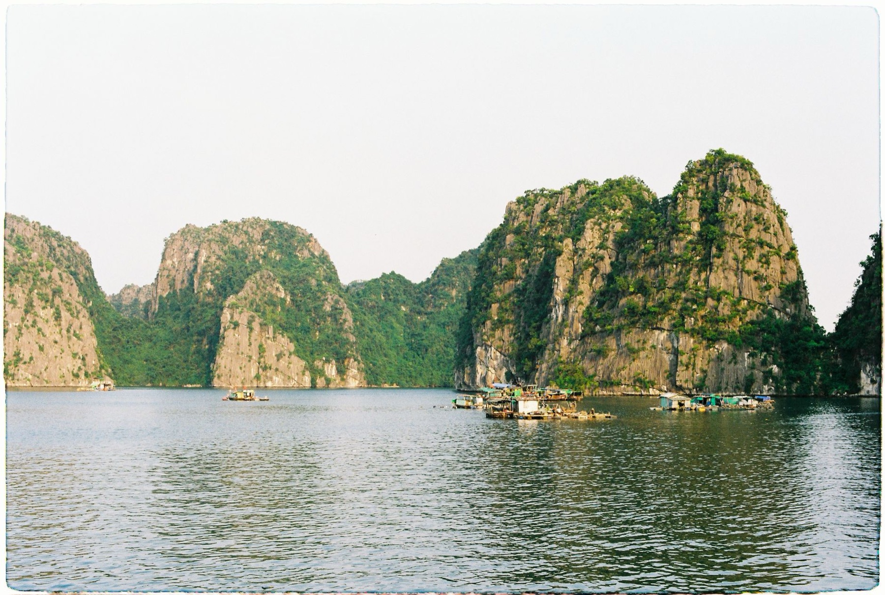
Should you buy a map before arrival or on a tour boat?
Buy before you travel if precision matters to you. Tour boats provide basic printed maps at no cost, but they're often simplified, printed in grayscale, and designed for "here's where we're going" rather than independent exploration. If you want to understand the geography—naming major island clusters, spotting fishing villages, or plotting a return visit to a specific grotto—a detailed folding or digital map gives you 3–4 weeks of planning advantage.
Buying on tour boats is possible at visitor centers in Halong City (around 80,000–150,000 VND / $3–6 USD), but stock is limited and selection is tourist-tier. Bringing one from home costs less and is lighter than buying locally.
Which Ha Long Bay map format works best for your cruise type?
| Format | Best for | Durability at sea | Price range | Why it wins |
|---|---|---|---|---|
| Laminated folding map | Deck reference, cave navigation | Excellent (waterproof) | $8–12 USD | Fits pocket, readable in sunlight, survives spray |
| Digital offline app | Independent exploration, self-guided walks | Excellent (phone protected) | Free–$8 USD | No data needed in karst zones, zoomable detail |
| Large topographical print | Post-trip wall art, study before booking | Poor (fragile, not waterproof) | $18–25 USD | Highly detailed, beautiful; leave at home or hotel |
| Cruise-included paper map | Quick cabin orientation | Poor (tears easily) | Free | Zero cost; understand vessel route only |
24-hour overnight cruises: laminated folding map + digital backup. You'll use the paper map in your cabin and on deck; the digital app helps if you wander ahead on shore excursions.
Multi-day (2–3 night) tours: all formats useful. Bring the folding map, download offline app, and buy a souvenir print to study route details before and after the cruise.
Independent (rented boat or kayak): digital offline map is non-negotiable. You need real-time location tracking and depth contours to stay safe in unmapped shallow zones.
🗺️ Plan your route: Vietnam itinerary
How detailed should your Ha Long Bay map be?
Tourist-level maps show main islands, Surprises Cave, and Monk's Head rock, with major cruise routes highlighted. They're clear but miss smaller grottos, fishing villages, and named limestone formations that locals reference. Topographical maps (1:50,000 or finer scale) add contour lines, depth soundings, and unofficial landing points—useful if you're kayaking or doing a private boat hire.
For a standard 2–3-day cruise, tourist-level detail is fine: you'll see the famous landmarks and understand the geography. If you're returning for multi-day exploration or kayaking, invest in a detailed print or high-zoom digital version. Maps with English and Vietnamese place names are worth the slight cost premium because you can ask locals and cross-reference on the boat.

What to check before you buy a Ha Long Bay map
Before ordering online or in-shop, verify:
- Year of publication: older maps miss recent path improvements and new cave access points. Aim for 2024 or later.
- Scale and legibility: if text is smaller than a postage stamp, it's decoration, not navigation.
- Language: English-Vietnamese hybrid helps with crew communication; Vietnamese-only maps are cheaper but require translation.
- Waterproof certification: if the seller doesn't explicitly say "laminated" or "waterproof," assume it isn't. Sea spray and rainwater will destroy uncoated paper.
- Included landmarks: check that Surprises Cave, Titop Island, Monkey Island, and Halong City are clearly marked. If they're missing, the map is incomplete.
Physical copies: order 2–3 weeks in advance if shipping from outside Vietnam. US orders via standard international mail take 5–10 days. Digital apps: test them on your phone at home (download offline tiles while on WiFi) before the cruise.
🎟️ Compare tours & tickets for this place
Where to get a Ha Long Bay map in 2026
Best-value option: download Maps.me or Gaia GPS offline beforehand (free). Both show Ha Long Bay in high detail, work without signal in caves, and update regularly.
Physical map in Hanoi: bookstores near Hoan Kiem Lake and the Hanoi Old Quarter stock imported folding maps and souvenir prints. Expect 200,000–400,000 VND ($8–16 USD) for quality laminated versions.
On arrival in Halong City: visitor center kiosks (80,000–150,000 VND / $3–6 USD) sell basic tourist maps. Quality is hit-or-miss; stock varies.
Cruise company: most 3–well-made tour boats provide a complimentary cabin map with your itinerary. It's basic but useful as backup orientation.
Souvenir-first option: if you want a keepsake you'll frame at home, browse our travel art & prints collection for Ha Long Bay–themed pieces. These aren't navigation tools but capture the experience beautifully and work well as gifts.
📸 Book an ao dai photoshoot in Hanoi or Saigon (Cáo Studio)
Real mistakes people make with Ha Long Bay maps
Leaving a paper map in the cabin: it's useless if you're on deck or exploring a grotto. Keep a folded copy in your pocket or on your phone.
Not downloading offline maps before boarding: once you lose cellular signal in the karst zones (common), Maps.me becomes a blank screen unless you've pre-cached tiles. Do this on WiFi in your Hanoi hotel.
Buying a map for a tour you've already booked: most cruises include orientation, and you don't need a detailed map for a guided itinerary. Save money; use the free boat map + a digital backup.
Assuming Vietnamese maps are cheaper to translate: English-Vietnamese dual-label maps cost only 10–20% more and save confusion when asking crew for directions.
Framing a souvenir map then realizing it's crooked: if you're buying a print for your wall, check alignment and color accuracy before leaving the shop or unpacking. Once framed, returns are difficult.
One honest angle: most travelers over-prepare. A free cruise map + a 2-minute offline app download solves 95% of navigation needs. The souvenir print is for memory, not navigation—treat it differently.
🗺️ Plan your route: Vietnam itinerary
Pair your Ha Long Bay trip with exploration of nearby regions. Ninh Binh offers similar karst scenery on freshwater. Hanoi is the logistical hub and worth 3 days of culture and food before or after. For a longer northern loop, add Sapa for mountain trekking, or head south to Hoi An or Ho Chi Minh City for varied itineraries.
Data tip: bring a Vietnam eSIM for offline map backup and tour guide communication. It's around $5–15 USD for a week of data and removes navigation anxiety.
Visa note: ensure your Vietnam e-visa is approved before travel. Maps won't help you if you're stuck at immigration.
FAQ
Is a Ha Long Bay map necessary if I'm on a guided cruise?
Not essential—guides handle navigation and point out landmarks. A map adds context (understanding the geology, spotting named islands) and helps if you explore independently on shore days. Consider it optional enrichment, not a requirement.
Can I use Google Maps offline in Ha Long Bay?
Yes, but download tiles in Hanoi or Halong City before boarding. Signal is unreliable in limestone zones. Maps.me and Gaia GPS have better offline detail for Ha Long Bay specifically; test them first.
What's the best scale for a Ha Long Bay folding map?
1:50,000 to 1:100,000 shows major islands and caves clearly without being too dense. Tourist maps at 1:200,000 are simpler but miss hiking trails and kayak landing spots.
Should I buy a map souvenir if I'm not going to use it for navigation?
Only if you want wall art or a gift. Quality topographical prints make beautiful home decor. Check the detail level and frame quality before buying—cheap ones fade and won't look good in 5 years.
Do cruise boats sell maps onboard, or should I buy before arriving?
Boats provide a free basic map in your cabin. Upgrade maps (detailed, laminated, English-Vietnamese) are rarely stocked onboard. Buy before travel or in Halong City visitor centers for better selection and price.
FAQ
Is a Ha Long Bay map necessary if I'm on a guided cruise?
Not essential—guides handle navigation and point out landmarks. A map adds context (understanding the geology, spotting named islands) and helps if you explore independently on shore days. Consider it optional enrichment, not a requirement.
Can I use Google Maps offline in Ha Long Bay?
Yes, but download tiles in Hanoi or Halong City before boarding. Signal is unreliable in limestone zones. Maps.me and Gaia GPS have better offline detail for Ha Long Bay specifically; test them first.
What's the best scale for a Ha Long Bay folding map?
1:50,000 to 1:100,000 shows major islands and caves clearly without being too dense. Tourist maps at 1:200,000 are simpler but miss hiking trails and kayak landing spots.
Should I buy a map souvenir if I'm not going to use it for navigation?
Only if you want wall art or a gift. Quality topographical prints make beautiful home decor. Check the detail level and frame quality before buying—cheap ones fade and won't look good in 5 years.
Do cruise boats sell maps onboard, or should I buy before arriving?
Boats provide a free basic map in your cabin. Upgrade maps (detailed, laminated, English-Vietnamese) are rarely stocked onboard. Buy before travel or in Halong City visitor centers for better selection and price.